Shared Use Tracks on kunanyi/ Mt Wellington
Consultation has concluded

Thank you to everybody who engaged with this project, it has been fantastic to read all of your contributions.
There were over 1000 responses with more than 3500 comments and we have worked our way through all of them to create an Engagement Report detailing what we heard you say.
The data from this survey will feed into the draft Mountain Bike Network Plan which is due to go to both Committee and Council in early 2020.
The City of Hobart is developing a mountain bike network plan to improve riding experiences on the the lower slopes of kunanyi / Mt Wellington.
People may prefer to share tracks and trails with their own user group (for example, walkers with other walkers , mountain bikers with other mountain bikers) but we want to hear from you.
This survey will ask which activity you identify with most strongly - as a mountain bike rider, walker or runner - and will then take you through a series of questions that will:
- help inform the development of our mountain bike network plan;
- improve mountain biking experiences on our track network;
- take into consideration the experiences of other users.
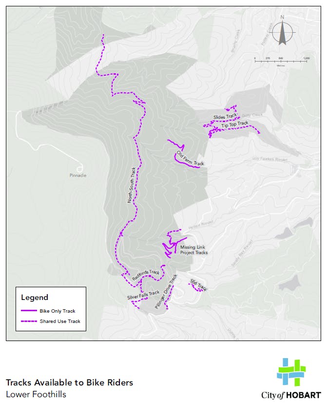
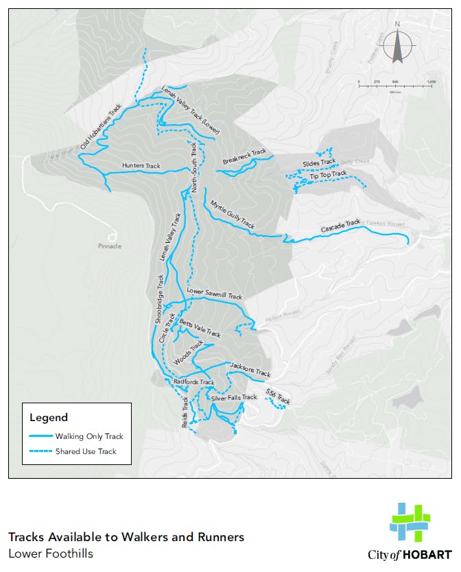
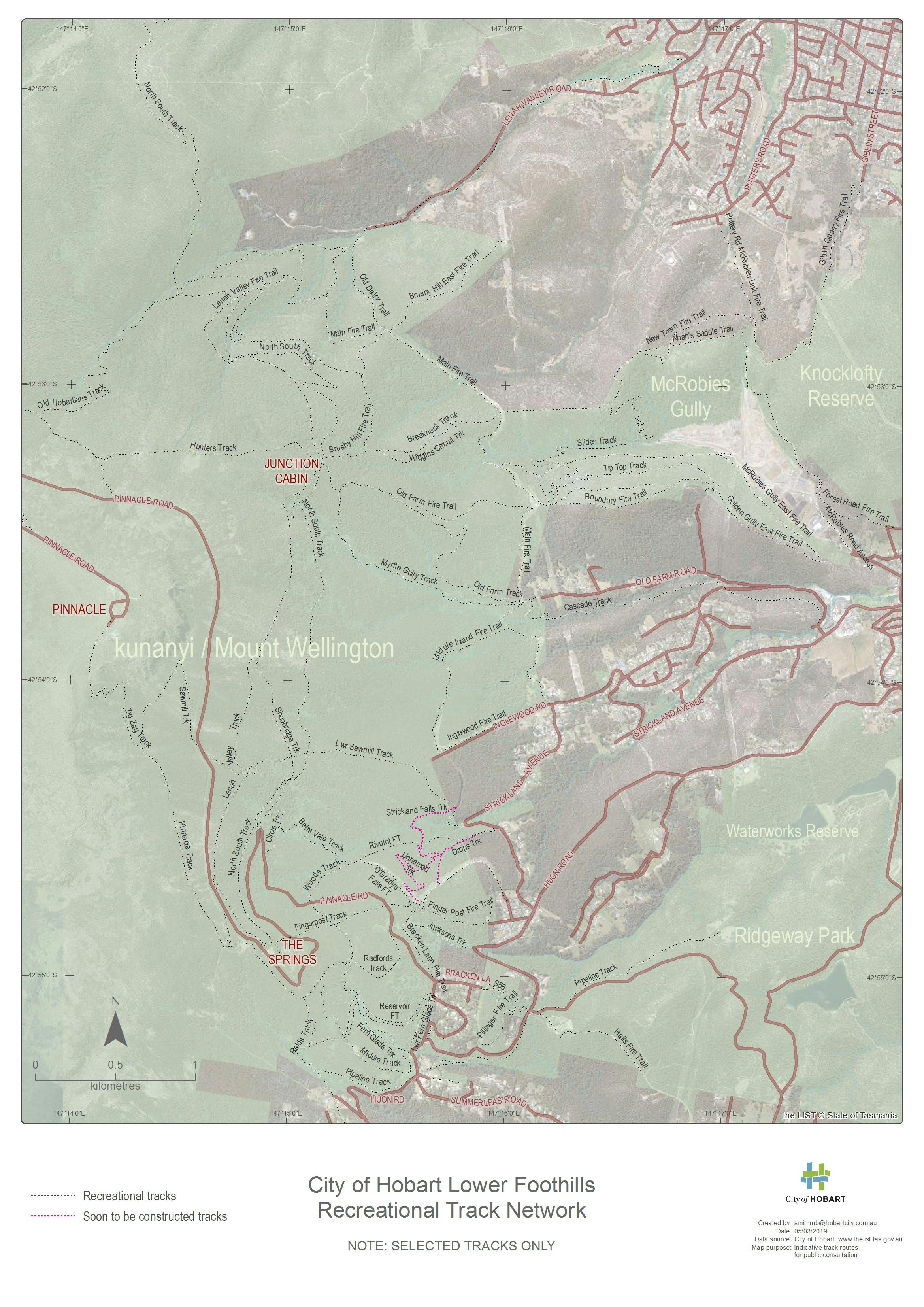
We have provided a number of maps that show how many of our tracks are available for riders, walkers and runners. Fire trails, although they play an important role in our track network, were built for emergency and operational reasons and so have not been shown on these maps.
We encourage you to provide general comments at the end of the survey.
Note: Any new track developments are dependent on a number of factors including cultural and natural value assessments and available funding.
Signup Banner


Photos
Photos
Photos
Who's listening
-
Community Engagement Officer

Phone (03) 6238 2831 Email paulsena@hobartcity.com.au
Signup Banner