Fern Tree Bushfire Risk
Consultation has concluded
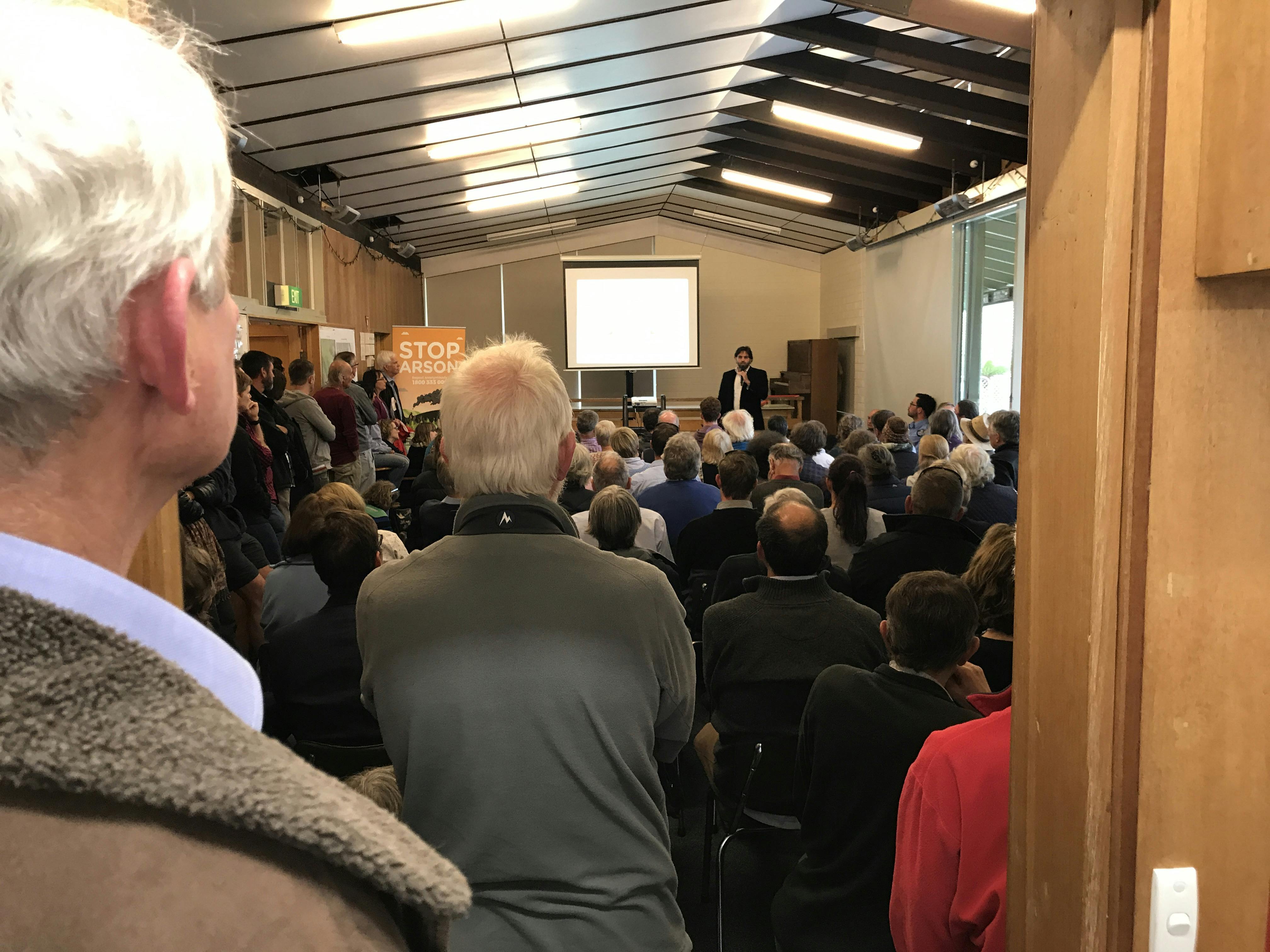
In late January the City of Hobart held a community forum with Fern Tree residents, to educate the community about the risks of major bushfire, and to undertake community consultation on the potential implementation of the Tasmania Fire Service Fuel Break Guidelines in the wet eucalypt forest area around Fern Tree and Wellington Park.
During the next stage of the engagement listening posts were held on Saturday 22 and Sunday 23 September 2018 for residents to learn more about the Fuel Break Guidelines’ recommendations, and discuss the impact these would have on site. These meetings provided a platform to talk about the desired visual outcome and how bushfire protection can be integrated across private and public lands.
Approximately 20 residents attended each listening post and all were supportive of the proposed fuel break works. There was a keen interest in a program of partnership with Council to improve bushfire protection on private property as well. Residents in attendance are invited to send in further comment via the feedback form below. Further information provided on the day is also available in the document library on the right of this page.
Thanks to all who have participated in the engagement process your feedback and support is important input into the final plans that will be presented to Council later this year.
Any questions you have regarding the community meeting in Fern Tree can be asked here. We will do our best to direct your questions to the appropriate personal and respond as soon as possible.
-
Thank you for providing locals with an expert to discuss fire the fuel load reduction at the start of Wellington Park on the pinnacle roadon Saturday 22/9/2018. Clearing the understory and ground to a distance of 45 metres from homes sounds like a fantastic plan. Can you confirm when this will happen please?
Rosemary Holloway asked about 7 years agoThe proposed fuel break extension works are currently open for public comment using the Your Say Hobart website. Once comments have been received the proposed works and comments will be incorporated into a report to the Parks and Recreation Committee of Council. The final report will be provided to full Council in December.
The proposed fuel break extension program has been presented to the Wellington Park Trust and detailed plans will be provided to the Trust to seek approvals for works within Wellington Park. A process for selection of a contractor to undertake all approved works will be completed in December/January.
It is anticipated that on ground works will begin in February/ March after the Christmas school holidays and peak visitor period to avoid traffic congestion and recreational users in the area. Those works that have been approved will be completed before April 2019.
-
Attended the listening post meeting on Saturday. Fully supportive of the proposal to reduce the fuel load around pillinger drive and the top of bracken lane. Hope it can be done soon.
ju asked about 7 years agoThank you for your comment.
-
I attended the bush fire risk meeting in Pillinger Drive on Sept 22nd and totally agree with the proposed green fire belts. Not only will it beautify the area for tourists and locals but also give some protection to the homes in the area. Great meeting all round.
Vallie asked about 7 years agoThank you for your comment.
-
Thought today's meeting at Pillinger Drive - 1.30 - 3pm was very beneficial and I agree with John' Fisher's proposal . as a resident of Bracken Lane any steps to protect property from wild bushfires are welcome.Well done for this initiative from the Hobart City Council
David Kremmer asked about 7 years agoThank you for your comment.
-
I'v got the information from the listening post at the reservoir track and Pillinger Drive junction. The proposal for the green firebreak sounds like a great idea. A break between the houses and the bush with much improved fire protection for the houses around the area. I have no questions about it, but I'm just registering my support for the idea and couldn't see anywhere else to register that.
David Loveridge asked about 7 years agoThankyou for your comment.
-
We would like to know when & if the section of bush between the reservoir & the houses on Curtis Av will be cut back or burnt off? Thank you
Neil and Ness Broadbridge asked over 7 years agoThe current Fire Management Plan for Wellington Park does not identify any proposed fuel management behind the western most properties in Curtis Avenue. However the City of Hobart has developed a new layer of proposed fuel breaks on this boundary which is based on the advice from the Tasmania Fire Service. Public consultation is currently underway regarding this proposal which will need to be incorporated into the revision of the Wellington Park Fire Management Strategy.
The specific works in Curtis Road include a new fuel break around the reservoir and a new fuel break behind no’s 18 and 20. The Tasmania Fuel Break Guidelines do not prescribe a fuel break behind the properties between 6 and 16 Curtis Road and therefore no fuel break is proposed in that area. This assessment arises because the offset from bushland to the existing asset is sufficient for the fuel break to be wholly contained within the private property allotment. There is no requirement for additional clearing of the public land adjoining the NW property boundary to achieve the clearances recommended in the guidelines.
Landholders are advised to consider their bushfire survival plan and consider the proximity of bushland to the house by referring to the Tasmania Fire Service Fuel Break Guidelines. The most important action that can be taken to protect a house is to reduce the fuel closest to the asset in order to reduce radiant heat and direct flame impingement during a bushfire.
-
It was indicated at the Jan meeting that the BBQs in Fern Tree were going to be replaced with gas ones soon. This is 4 months ago? Is there any update on this. There a number of people who use these BBQs and don't put them out providing a fire risk right on our door step.
VC asked over 7 years agoThe development of the master plan for the Fern Tree Park Visitor Node is well progressed and final consultation will soon commence. A development application will then be submitted and will need to be approved before work can begin. It is anticipated that works would begin in late 2018. The replacement of the BBQ's will be undertaken as part of that redevelopment.
-
Could council building approvals be reviewed to restrict development in hazardous areas? Can all above ground power and service cables be put underground? Can council identify escape routes and ensure they are accessable during emergincy times?
Len Spaans asked almost 8 years agoThe City of Hobart includes the current Australian Standard (AS3959) for building in bushfire prone areas in any new development application. This requires a Bushfire Hazard Assessment undertaken by a qualified assessor prior to development application to determine a Bushfire Attack Level and ensure that the appropriate level of risk of bushfire is considered in the development or building proposal. A Bushfire Prone Are is defined by the City of Hobart by applying principles provided by the Tasmania Fire Service and utilises slope, aspect, vegetation type and predicted fire front impact. The process will dictate minimum standards for building design and siting for prospective builders to improve bushfire survivability. The AS 3959 was developed in 199 and subsequent revisions in November 2009 and November 2011 incorporated new research and lessons learnt from major incidents.
The provision of power to existing houses and developments falls within the responsibility of the landholder or TasNetworks depending on the connection. TasNetworks describe the standards they apply and the work they undertake to mitigate the risk of bushfire arising from power lines. Some examples of this work include the clearing under and around power lines and the use of aerial bundled cables in tall forest where the removal of trees would be prohibitive. A good source of information for landholders and residents can be found on the TasNetworks site at https://www.tasnetworks.com.au/safety/safety-campaigns/safe-growing-near-powerlines/.
The individual Community Bushfire Protection Plans for communities in Tasmania are available on the TFS website and the plans identify Neighbourhood Safer Places where available and also identifies escape routes (http://www.fire.tas.gov.au/Show?pageId=communityProtectionPlanningProjectPublic). The City of Hobart undertakes regular inspections of these routes to ensure that the roadside vegetation is safe in the case of a storm or bushfire and trims or removes trees that do not appear sound. This has been recently undertaken on Strickland Drive and further work is proposed on other key routes near Fern Tree such as Huon Road. On the day when an incident arises the exact choice of route will depend on where the fire develops and what route is safest.
-
I would like more information about the risk, or otherwise, of eucalypts in the vicinity of houses. We live next to the bush but have removed eucalypts that were close to the house and were on our property. However there are eucalypts (small-leaf peppermints) along the Summerleas Road edge at the front of the property (they are outside our property boundary) and they are close to our house. There are also eucalypts on some neighbouring properties. I do like these trees (!) but that is irrelevant when it comes to our survival. And of course there is always a lot of bark, leaves, sticks to rake up after a strong wind. Our situation would be relevant to quite a few other properties in Fern Tree, and elsewhere. Apart from how much risk these trees might cause I would like to know who is responsible for removing roadside trees (that are within the road easement) and on private property where these might pose a danger for neighbours.
Catharine Errey asked almost 8 years agoThe presence of individual trees is not in itself a key bushfire threat. The assessment of bushfire risk and the threat to the survival of houses from bushfire relates to the type, density and arrangement of the fuel contained within a bushland area and the proximity to the asset. The TFS referred to the Bushfire Survival Plan as a guide to preparing your property and how to treat the vegetation to reduce the risk. This is a useful reference and is available on the TFS website. Trees, especially gum barked Eucalypts are often retained in fuel breaks to help slow the wind and to trap embers that might arise from a bushfire in the vicinity. However heavy understory and continuous elevated fuel is removed to ensure that any fire front is unable to climb into the canopy or produce excessive flame length that might generate radiation heat sufficient to damage or destroy a nearby property.
However if a tree represents a threat to adjoining property or is diseased or damaged to the extent that it is unstable then the City of Hobart will do arboriculture works on the tree or remove it to address the risk. Each tree is assessed on its merits in order to retain both the habitat and visual amenity of the roadsides but also to ensure public safety. If you have a specific concern please contact the City of Hobart on 6238 2711 and we will make a time to inspect the site.
-
Hi, In relation to controlled burns and fire tracks. What is the plan in relation to the fire tracks at the top part of Summerleas Rd that come out at Reid’s Rd, Westringa Rd, Menuggana Rd and down to Scott’s Rd? I am aware that one home owner maintains the track on the gravel part of Summerleas that goes down the gully to meet with the Scotts Rd and Menuggana tracks. Is there any plan (is it possible to do) for reduction burns in Summerleas Rd through the gullies? Regards,
E&R asked almost 8 years agoThe land you refer to is wholly privately owned and part of a number of large properties in the area bounded by Reid’s Road, Westringia Rd. Menuggana Rd and Summerleas Rd. The City of Hobart does not hold any land or manage any fire trails in that area so I cannot help with future plans for hazard reduction burn plans or fire trail maintenance plans.
I have forwarded your query to the Fuel Reduction Unit, Tasmania Fire Service and we will post a reply when it is available. It is worth raising the issue with the local TFS Brigade who can work with landholders to undertake hazard reduction on private property as a joint operation if the landholders wish to undertake such works.
Key Dates
-
22 September 2018
-
23 September 2018
-
31 January 2018
Important documents
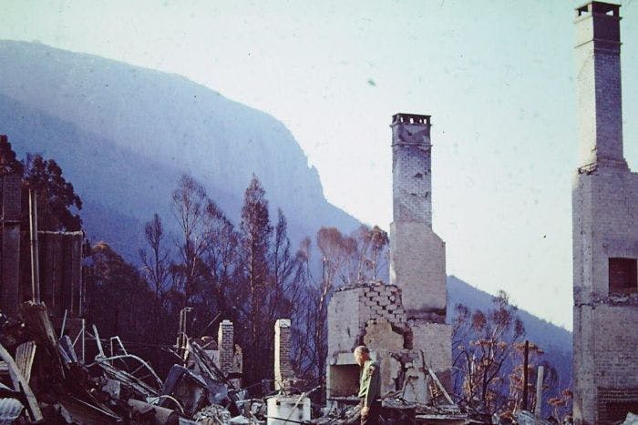
1967 Bushfire Images

Community Meeting Presentations
Photos
Signup Banner

Videos
-
 Click here to play video
What is Bushfire risk
Click here to play video
What is Bushfire risk